Trip Report
Ennis Cave Weekend 4/29-30/23
Trip Date: Apr 29 2023A 2-day photo trip to one of Arkansas’s Longest Caves
Ennis Cave is located in Stone County, Arkansas where many of Arkansas’s longest caves can also be found. It is currently listed as the 6th longest in the state at around 5 miles. The cave was mined for manganese between 1939-1941. Cavers first began mapping the cave in 1959. In 1975, the entrance to the cave collapsed, closing off all exploration for many years until it was dug back open in 1985. Since then, a campsite has been continually developed (with outhouses, a cabin, a 2-story pavilion, etc.) and Ennis has been host to many events.
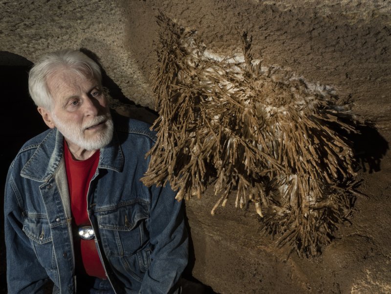
While Ennis Cave has not had any formal survey work done in some time, it is still very much an active project. The current caretaker of the cave, Tim, lives near the entrance to the property in a rustic cabin without any electricity or cell service. Tim has been involved with Ennis since at least 1985, when he helped dig back open the entrance and ultimately install the culvert to prevent it from further collapses. Tim was known for taking multi-day solo trips into Carroll Cave in Missouri, exploring the depths of the cave and discovering lots of virgin passage. He was known for caving without a helmet and using a hand-held carbide lantern. Today, he still doesn’t use a helmet, but has adopted the use of LED lights.
Tim has spent decades inside Ennis digging out passages. He doesn’t just dig open a passage so that he can fit... He turns a sediment-filled passageway with 2” of airspace into something big enough to walk one of his many wheelbarrows down the newly created corridor to continue his dig on the other side. He has terraformed rooms and created new/easier routes to various parts of the cave. He has carved out steps and walkways. He buried his two dogs inside the cave and created a memorial for them. But most importantly, he has opened up new major areas of the cave and made several significant discoveries. Tim used to spend nearly every day of the week digging in the cave. But at age 75, he currently only dedicates his Mondays to digging in Ennis.
Rick Hines announced at a KCAG meeting that he was going to be setting up a photo trip to Ennis Cave and I was quick to sign up. The drive over from Kansas City was about 6 hours, but I took my time and made a few pit stops and wound up arriving around 7pm Friday evening. Rick and Matthew Hernandez arrived earlier in the afternoon and were talking with Tim when I arrived. Tim eventually brought us into the cabin where a large map of the cave was printed out and pointed out areas in the cave that he was currently digging in (fortunately in the parts of the map which had not been chewed up by rats!). Krista Bartel and Jessie Bridges arrived later in the evening, and we planned to be ready to enter the cave by 9:30am.
DAY 1
Kayla Sapkota along with Drew and Amy Westerman arrived Saturday morning. Drew and Amy planned to enter the cave later than the rest of the group to target a couple areas closer to the entrance for photographs. Rick divided up photo gear and gave us a quick lesson in helping him out with the flashes. We gathered in front of the culvert entrance around 9:45am for a group photo then headed down the 45’ ladder.
There are still remnants from old wooden support beams from the mining days in the cave, and a cluster of mushrooms were growing along one of them which were a neat sight to see underground. We passed Winged Victory where one can buttslide down a mud slope or take the carved out stairs down to continue along the walking passage. We headed west deeper into the cave along a large walking passage with a gravel floor, and eventually headed up a slope to the right to a room called the Rose Rotunda. This room contains a DIY chandelier made out of old metal wagon wheels and filled with candles. There are dozens of other candles scattered throughout the room and on certain events throughout the year, they will light them all up.
From the Rose Rotunda, we headed into the East Maze area where some of Tim’s current dig projects were located. We first helped Rick photograph the Shelf Room, then headed toward Tim’s dig in the “Tres Dome Passage”. We photographed a nice helectite high on the wall here while Tim continuously splashed with water seeing if he could clean the mud off of it.
Next we split away from Tim and headed toward “Lost Paradise” and photographed some formations there, then explored and photographed “Rainbow Mud Canyon” briefly. We then went back to Tres Dome and saw a really spectacular area called the “Sistine Chapel” with a ton of white, clear and orange crystals and helectites along the high walls and ceiling. They were all very small and intricate and looked much more impressive in person than they do in pictures. But that area was definitely a highlight of the trip.
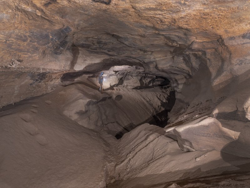
We took a quick detour down a short crawlway into “Crystals Room” which featured a long sloping wall with flowstone and small helectites. Then we headed back down to the main gravel-floored borehole heading further west into the cave. We passed “Goose Pit” where a jutting rock that looks like a duck bill has been adorned with carbide eyes above it. Eventually we reached the largest room of the cave which is just called the “Breakdown Room”. The room is over 200’ long and 150’ wide and filled with giant breakdown blocks. We climbed up and over it and everyone took a break on the far side while I ran down another one of Tim’s digs to see the “Alien Room”. We eventually headed further west and wound up getting a bit mixed up after trying to find the way past the “Cairn Room”.
We decided to wrap it up for the day and head back toward the entrance, but would stop and view the 100’ waterfall on the way out. A couple of us headed over to this area only to discover that we would have to wade through knee deep water (waist deep for everyone else) to get there. With another cave trip planned for the next day, I opted to keep my boots dry and we went up to a balcony area which overlooks the waterfall room. The view and the room was much more impressive than I had expected. It was a nice 15’ diameter window 50’ up looking across to enormous white calcite flowstone formations. I planned to visit the bottom of the room the next day.
We were out of the cave by 4:30pm with plenty of time to run into town for Mexican. Unfortunately it was a dry county so we continued another 30 minutes after dinner to a brewery just before sunset and spotted a bald eagle at the side of the road along the way. Back at camp, we sat around the campfire and shared stories and eventually headed to bed.
DAY 2
In the morning, Rick and I took a quick trip down into the entrance to photograph the mushrooms growing along the old wooden support beam. Rick forgot a battery and had to return to the surface so I explored a bit and climbed up a wobbly 25’ ladder and found the “Birthday Room”. Along with several barrels full of supplies and kerosene, this room features large chunky flowstone columns over 20’ high. Eventually Rick came back down and had me pose at the base of the ladder, while I was still wearing the sweatpants I had slept in.
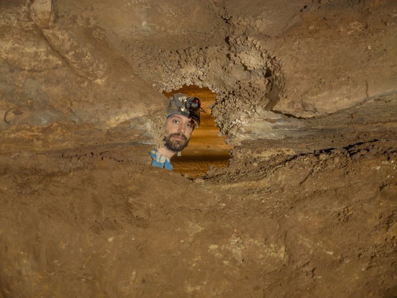
The full group didn’t enter the cave until nearly 11am. Our main objective was finding the correct route around the Cairn Room to the final section of the cave. We got as much info as we could from Rick ahead of the trip. We first stopped at “Jack & Emma Junction” where the memorial for Tim’s dogs is located. Tim also has another bunker of supplies in this area. Next, I climbed over a high saddle to pose inside of a small window that was (maybe) on the list of places to photograph. We took a different route into the breakdown room where a 6’ tall well-balanced stack of rocks acts as a staircase to exit from a short phreatic crawl-tube.
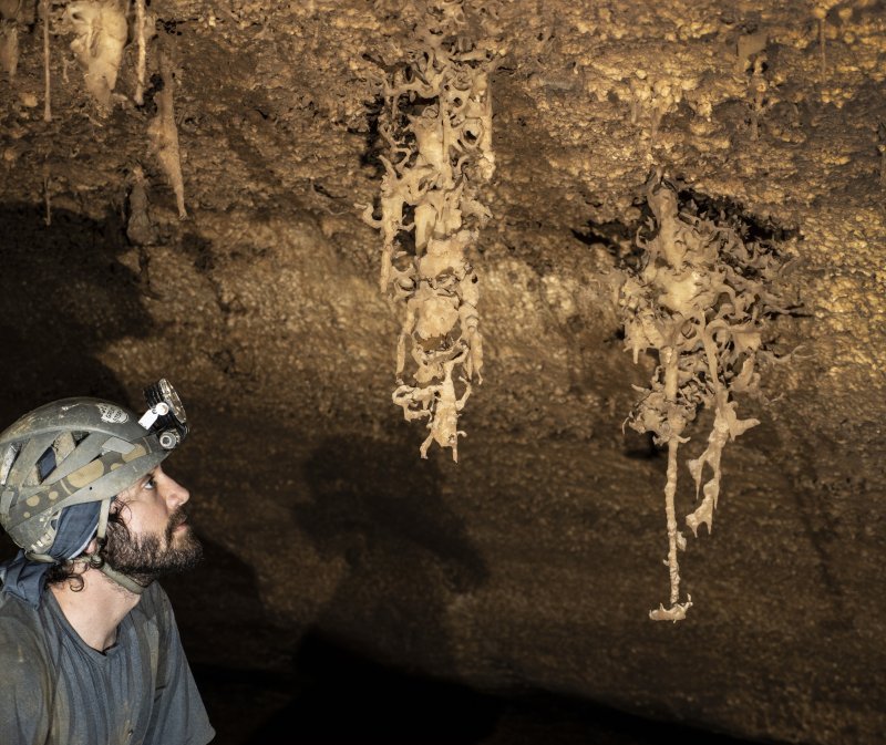
Jessie and I scouted ahead to confirm the route past the Cairn Room while Rick, Krista, and Matthew stayed behind. We hoped it would be a quick project but wound up taking around 40 minutes. We successfully identified both route options and went back to see if Rick would be up for them. The route would involve a bit of crawling over breakdown and a short squeeze. Halfway there we stopped to photograph “Register Rock” where the cave register used to be located. Then we continued on through the crawlway and made it to “Orgy Gorge”. We found some very chunky crinoid fossils along the ceiling in this area. Jessie and Krista went ahead while Matthew and I assisted Rick in taking some photos of the mud covered helectites in this area.
Eventually Jessie came back and I ran ahead and met up with Krista who was still further back in the cave. I passed by an old Rainier beer can and got to the “Final Formation Room”. There was a particularly phallic stalagmite here which had a white candle on top with wax dripping all down it which was an interesting sight. The room sloped down in the middle and there was one final obstacle, the “Blowhole”, a small body tube that drops down ~15 vertical feet into a muddy room with some formations. A handline is rigged to help navigate through this body tube and Krista and I both went down to view this final room. I took some photos of a neat transparent crystal drapery then we both made our way back to the group.
It was 3pm and we had pretty much hit all of our photo objectives, so Rick and Jessie headed toward the exit, while Krista, Matthew and myself went back to the 100’ waterfall room to view it from the bottom. This involved wading in the deep water before popping up into the impressive room. The water falls down from a large slit in the ceiling and lands in the center of the room. We spent a few minutes admiring and taking photos, then headed back toward the exit. We were out of the cave by 4pm.
The Ennis Cave property is located 3 miles from a public access ramp to the White River and everyone said it was worth a visit, and it did not disappoint. I drove along the dirt road in the covered forested area which eventually opened up into a massive field filled with yellow wildflowers. I could see the 200’-high bluffs off in the distance. A wild turkey ran across the field as I drove through without seeing a single person. It was quite a scene. I finally got to the water which had a pretty strong current and the wind was howling through the trees. The moon was visible just over the top of the bluffline. Arkansas... you pretty. I also did a short loop hike at Devil’s Knob in the Devil’s Backbone area just before sunset and got a great view of the rolling hills of the Ozark Mountains. I again didn’t see a single person. Made the long drive home and got back shortly after midnight. Now to plan and pack for SERA...
Click here to view my entire archive of trip reports & caving articles